Category Archives: alpine archaeology

Developments in Swiss glacial archaeology

Glacial archaeology in Switzerland has been on the move. And that was long overdue! Glaciers and ice patches are melting at heart stopping rate in the Alps and valuable archaeological ressources are being lost without us having the chance to record, investigate and understand them!

10-10-010 Glacial archaeologists from Switzerland and Italy met last May in Berne and the meeting resulted in quite a bit of media interest. The meeting was innitiated by the L’Académie suisse des sciences humaines et sociales (ASSH/SAGW) and they have set up a website with with a number of ressources concerning the meeting and glacial and ice-patch archaeology. Do have a look, esp. also at the glacial archaeology dossier in their Bulletin (2/2019)! And certainly not just because I was also fortunate to be allowed to contribute something about the so far little known “Fuorcla da Strem Sut”-site, the oldest glacial archaeological site from the Alps, dating back to the Mesolithic.

SAGW/ASSH – Gletscherarchäologie

Furthermore, there was an amazing little exhibition at the Geschichtsmuseum in Sion, VS about glacial archaeology last winter. And lastly, the Konferenz der Schweizer Kantonsarchäologen und Kantonsarchäologinnen (KSKA) has build a website which instructs the public and all those who are regularly activ in the Alps what to do in case of archaeological finds on or near ice patches or glaciers in the Alps, it’s called ALPARCH.CH

If you go hiking, climbing or mountaineering or work in the Alps, bookmark this site on your mobile phone and notify archaeologists if you find something interesting! And don’t be shy. It’s hard, even for archaeologists, to see on first sight, whether something is interesting or not, and we rather go and look a few times with limited success then loose more finds. We love to hear from you!


Mountains and prehistory at the EAA 2019 meeting in Bern

In roughly nine months many, many archaeologists will be swarming the streets and filling the “Beizen” (the name for restaurants etc. in Swiss German) of the beautiful city of Bern. They will gather here at the 2019 EAA-meeting to share their news and ideas. It will not only be an opportunity to see old friends and make new ones, but also to wander through the city‘s old centre, swim in the Aare (if the weather permits), have a cheese fondue or raclette and a glass of local wine (or beer!) or visit the 3-Lake region, or the nearby Alps of the Bernese Oberland. And, of course, one almost forgets, to discuss fascinating archaeology!

With the Alps nearby and the Alps being such an important part of the Swiss identity, it is no wonder there will be quite a few sessions based around themes concerning the prehistory of mountainous regions. I was lucky enough to be able to join forces with some wonderful colleagues and suggest two of these:

In search of “cloudstones”? Lithic raw material procurement in mountainous and alpine regions during the Mesolithic and Neolithic Session 252 EAA meeting 2019 (PDF)

  • Marcel Cornelissen – Archaeological Service of the Canton of Grisons / Universität Zürich (marcel.cornelissen (at) uzh.ch)
  • Astrid J. Nyland – Archaeological Museum, University of Stavanger, Norway (astrid.j.nyland (at) uis.no)

and also

Settling at high altitudes. Intra-site and and inter-site variability, site function and mobility of hunter-gatherers and the first agropastoral societies Session 319 EAA meeting 2019 (PDF)

  • Federica Fontana – Università di Ferrara (federica.fontana (at) unife.it)
  • Xavier Mangado Llach – Universitat de Barcelona (mangado (at) ub.edu)
  • Marcel Cornelissen – Universität Zürich (see above)

It would be great if you would consider contributing to either of these sessions and are curious about your research and thoughts. The deadline for contribution submission is February 14th! And if you don’t want to or cannot contribute a presentation/poster, do come and listen to some fascinating mountainous archaeology and meet us in person! There should at least be pretty mountain pictures. If you are not entirely sure if your research fits the session, have any questions about the format or have any other thoughts and questions, do not hesitate to contact any of the organisers. There are, however even more great mountainous archaeology sessions to choose from. In any case, we would love to hear from you!

See you in Bern!

EAA 2019 Bern

das auge des experten

… sieht bis in die Silvretta!silexanalysen im bahnhofsbuffet olten…

Source: das auge des experten

Après-Ski 2010 | Rückwege Blog

https://silvrettahistorica.wordpress.com/2017/01/13/apres-ski-2010/

An era coming to an end? Alpine archaeology will never be the same again!

So, that’s that. Last week I had the honour and immense pleasure to help dig a few trenches at Las Gondas in the Fimbertal, between the Lower Engadin and Paznaun valleys. The Rückwege project was initiated by Thomas Reitmaier in 2006 and this might or might not turn out to have been the last ever field season. 10 years of multi-disciplinary and highly successful alpine archaeological fieldwork have come to an end. It was a fantastic time and a great week away from the PhD. A week in which a wonderful group of archaeologists and friends, who have all been involved in the project over the years, got together to excavate a system of animal pens in the beautiful Fimber valley. We managed to sort out the stratigraphy and expect it to be prehistoric, perhaps chronologically comparable to the Iron Age hut ruins we excavated further down the valley. But, as so often in the Alps, finds are scarce. So, we’ll have to wait for the 14-C dates to come back.

I would like to thank my friends, and especially Thomas, for their companionship, the laughs, the snoring, the Streusel, the EIER, the Schnapps, wine and beer, the snow, Lassiter, the tons of charcoal and the many buckets full of dirt and stone. Do have a look at Thomas’s post on  the Silvretta-Historica blog, which I’ve linked to below as well!

 sodalla – wir sind also schon wieder gut zurück aus dem schönen fimbertal und einer sehr erfolgreichen einwöchigen grabungskampagne im gebiet las gondas  … . das hauptanliegen, die dortigen pferchstrukturen genauer zu untersuchen und hoffentlich im verlauf der nächsten wochen auch mittels 14c-datierungen zeitlich einzuordnen, haben wir mit einem ausgezeichneten und hochmotivierten grabungsteam problemlos erreicht, trotz der mitunter etwas widrigen wetterbedingungen …    (CLICK ON THIS LINK TO THE SILVRETTA-HISTORICA PROJECT BLOG FOR MORE INFO AND LOTS OF GREAT PHOTOS FROM THE FIELDWORK!)

Holidays in a rock-shelter. Early Mesolithic occupation of the Berglibalm in the Bisistal (Muotathal, canton Schwyz).

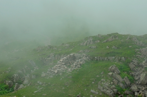
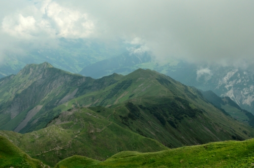
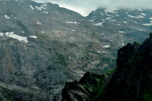
Last summer part of my holidays was spend with friends in a rock-shelter in the pitoresque Bisistal in central Switzerland. A badger had dug his/her sett in the abri and, doing so, brought up a few bones and charcoal. These were discovered by Walter Imhof, a speleogist, who has discovered and surveyed many sites and caves over the past decades. A small test-trench resulted in some stratified charcoal which was dated to the ninth millenium BC. After more bones and a rock crystal flake were found, it was decided to start a small excavation, organised by Walter Imhof and Urs Leuzinger. We dug a two by two meter trench where the archaeology was most threatened to be disturbed by further digging by our friend the badger, as well as a few more test-trenches to see if there were more areas of occupation.

berglibalm_regenbogen_haz_rel

Abri Berglibalm, Bisistal (Muotathal, Switzerland) during excavation, August 2015.

The results were fantastic! Worked bone finds from caves dating to the Early Mesolithic had been known from caves in the region, but now we found a decent collection of lithic artefacts (total 285, incl. 10 microliths) and faunal remains in a well-stratified, charcoal rich layer (probably the replaced remains of a fire-place). This greatly improves our knowledge of the Mesolithic in the alpine regions of Central Switzerland. Also, it was a fab week with friends and colleagues and a great break from the work on the PhD. Nothing better to clear your mind then listening to yodelling (as well as, sadly, quite a bit of german schlager music of a lesser quality) and friends snorring for a week, drinking mediocre beer, stomping up a hill every morning through a field consisting entirely of cow pads, breaking your back sieving, breakfasting with amazing cheeses and excavating great archaeology!

Mostly due to the fantastic engagement of Urs Leuzinger and the rest of the team, the site has already been comprehensively published in the Annuaire d’Archéologie Suisse (Leuzinger et al, 2016). It includes lithic analysis, ltihic raw-material provencing, charcoal-, palaeobotanical- and faunal analyses. It’s well worth a look!

Zusammenfassung
Die Fundstelle Berglibalm befindet sich in der Gemeinde Muotathal im Bisistal auf 1140 m ü.M. In der 4 m2 grossen Grabungsfläche von 2015 konnte eine frühmesolithische Schicht aus der Zeit um 8100 v.Chr. dokumentiert werden. Die vorhandene Holzkohle belegt Hasel und Ahorn als bevorzugtes Brennmaterial. Daneben kamen viele gut erhaltene Faunenreste, wenige botanische Makroreste sowie ein lithisches Inventar mit 285 Artefakten, darunter 10 Mikrolithen, zum Vorschein. Der Abri diente als Lagerplatz für mittelsteinzeitliche Jäger, die im hinteren Bisistal Jagd auf Steinbock, Gämse, Hirsch und Wildschwein machten.

Résumé
La Berglibalm est un abri sous roche mésolithique situé dans la vallée du Bisistal (commune de Muotathal), à 1140 m d’altitude. La surface fouillée en 2015, couvrant 4 m2, a livré une couche du Mésolithique ancien datée d’environ 8100 av. J.-C. On y recense des concentrations de charbons de bois – le noisetier et l’érable comme combustibles principaux. Le site a livré de nombreux restes de faune bien conservés, quelques macrorestes botaniques, ainsi qu’une industrie lithique comprenant 285 artefacts, dont 10 microlithes. L’abri servait de campement à des chasseurs mésolithiques à la quête aux bouquetins, chamois, cerfs et sangliers des régions d’altitude du haut de la vallée du Bisistal.

Bibliography

Full publication:

Leuzinger, U., Affolter, J., Beck, C., Benguerel, S., Cornelissen, M., Gubler, R., Haas, J. N., Hajdas, I., Imhof, W., Jagher, R., Leuzinger, C., Leuzinger, C., Leuzinger, P., Müller, W., Pümpin, C., Scandella, S., Scandella, T., Schoch, W. & Warburton, M., 2015, Der Frühmesolithische Abri Berglibalm im Bisistal, Gemeinde Muotathal (SZ), in Jahrbuch Archäologie Schweiz, Vol. 99, 7-26

Popular short text about the site:

Leuzinger, U. 2016, Dachs entdeckt Steinzeitfunde, in Archäologie in Deutschland, Nr. 1.

A short summary (EN) of the first preliminary results can also be found here:

Cornelissen, M. and Reitmaier, Th., In press, Filling the gap. Recent Mesolithic discoveries in the central and south-eastern Swiss Alps, in Quaternary International (to be published 2016; Click here for more infos / a PDF of corrected proof.
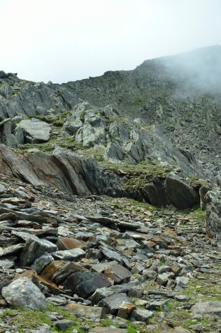
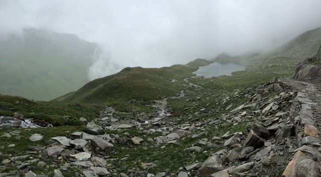
Filling some gaps – Recent research into the Mesolithic in the Swiss Alps

It was a scorching hot day in June 2014 in the Italian Dolomites. Now it is Febuary 2016. It is cold and dark out and I can’t wait to get on skis again. Still, it is a good day to think back on that hot June day when Thomas Reitmaier and I presented the results of a decade or so of Mesolithic research in the Alps of south eastern and central Switzerland at the MesoLife conference in Selva di Cadore. It is now available online!

Now you might think, is there any evidence for Mesolithic hunter-fisher-gatherers in the inhospitable high Alps? Well, yes there is. Up to 2007 hardly a handful of surface and loose finds were known. But many hours of dedicated fieldwork by many people have resulted in quite some new information. Thomas and I have tried to pull it all together and write it up. We were not only able to give a good impression of what we know of Mesolithic life in this part of the Alps, but also of what we do not yet know and what is to be done about that!

We are very excited that the corrected proof of the article is now available online as a preprint. So, get in your lazy chair in your snug warm room with a hot bevvy or a beer, look out on the wintery world outside and read all about the marvelous lives of people in the Alps 11’000 – 7’500 years ago. As you do, please also spare a thought for the archaeologists who spend days in rain, fog, sunshine and snow, with or without us, plodding across alpine meadows, climbing obscure passes and help dig innumerable – often empty – test-trenches.

Cornelissen, M., Reitmaier, T., in press. Filling the gap: Recent Mesolithic discoveries in the central and south-eastern Swiss Alps, Quaternary International (2016), http://dx.doi.org/10.1016/j.quaint.2015.10.121

ABSTRACT
Until 2007 only a handful of surface finds dating to between the end of the LGM and the Middle Neolithic were known in the alpine regions of central and south-eastern Switzerland. A number of recent rescue excavations, research projects and single finds have now shown the presence of people at high altitude in these parts of the Alps from the 9th millennium cal BC onwards. Both open-air sites and rock shelters are represented. Many sites lie above the valley floor, in the upper subalpine or alpine zones, and on routes to minor as well as major passes. Together with new palaeoenvironmental data, these archaeological finds allow us first insights into the nature of interaction of Mesolithic people in the south-eastern Swiss Alps with their social and natural environment, as well as their relationship with regions further afield. Furthermore, the finds allow us to start thinking about future research into the early prehistory of the south-eastern Swiss Alps.

I am sorry about the pay wall (but, pssst, check the publications page …).
And when this is not enough entertainment, look for the other preprints of paper on the Mesolithic of the Alps that resulted from MesoLife conference. Many thanks to the editors of Quaternary International and the MesoLife guest-editors for enabling us to publish this here!

Skiarchaeology III – Grindelwald


hazrel_Skiarch_III_grindelwald

In the centre of this photo you might recognise the mighty Eigernordwand. The Untere Grindelwaldglacier used to spill onto the valley floor out of the cleft in the rock just to the left of it. This “Eismeer” was one of the main attractions for early tourists in the Jungfrau region in the 19th century. R. Gubler wrote about the archaeology of early tourism in the region for the Day of Archaeology 2014. Click on the picture to find out more!

Follow this link to a map with a timeline which shows the dramatic retreat of the Untere Grindelwald gletscher.

Image

Skiarchaeology II – Oberhasli, Mägisalp

Whereas the #skiarchaeology I wrote about last, dealt with a site that can be seen from the slopes of the Crans-Montana ski resort, you pretty much ski over this collection of sites. The sites are located throughout the area that in winter is the Meiringen-Hasliberg ski-resort. And while the finds from the Schnidejoch are mostly prehistoric, the structures found here, at the Mägisalp, are most likely to date to the Middle Ages and (Early) post medieval times. Spread across this area, partly in the clouds on this photo, are the two highest Alps in the three-part “Alpwirtschaft”, or animal husbandry system, which is still in use here. How far back it dates, is difficult to say, but the earliest historical record dates to 1372 AD.

Oberhasli - Mägisalp, Switzerland. A relatively archaeologically well-studied "Alp", probably dating back to Medieval or Early post-medieval times.

Oberhasli – Mägisalp, Switzerland. A relatively archaeologically well-studied “Alp”, probably dating back to Medieval or Early post-medieval times.

In summer cows enjoy the herb-rich mountian pastures here, moving up with the vegetation during the summer months. Some of the buildings still in use might have a history of many centuries. But there are also the ruined remains of their predecessors now, in winter, hidden by snow. Sadly, it is often difficult to date such sites, but they still provide us fascinating insights into the cultural history of the region and the Alps in general.
The buildings and ruins have been studied by Brigitte Andres as part of PhD research at the University of Zürich. If you are interested in more, it is worth having a look at these publications:

Andres, B., 2011, Gadmen, Wendenboden. Eine alpine Siedlungswüstung im Oberhasli, Archäologie Bern 2011. Jahrbuch des Archäologischen Dienstes des Kantons Bern, 48–53.

Andres, B., 2012, Alpine summer farms – upland animal husbandry and land use strategies in the Bernese Alps (Switzerland). In: W. Bebermeier, R. Hebenstreit, E. Kaiser uad J. Krause (eds.), Landscape Archaeology. Proceedings of the International Conference held in Berlin, 6th – 8th June 2012. eTopoi. Journal for Ancient Studies Special Volume 3, 279–283.

Andres, B., 2012, Hanglage mit Gletscherblick. Alpine Wüstungen im Oberhasli. Archäologie Bern. Jahrbuch des Archäologischen Dienstes des Kantons Bern, 2012, 220–236

Andres, B. und Walser, Chr., 2013, Drohnen in der alpinen Archäologie. Luftbildaufnahmen von Alpwüstungen im Oberhasli. In Jahrbuch des Archäologischen Dienstes des Kantons Bern, 2013, 107-109

Image

Skiarchaeology I – Schnidejoch

Although one is not always aware of it, even when on skis or snowboard you are often surrounded by interesting historical or archaeological places. Some of the archaeological finds from the ice-patch on the Schnidejoch (on the border between the cantons of Berne and Valais), for example, are the oldest ice finds from the Alps. Fragments of a wooden bowl, goatskin trouser legs and a birchbark arrow quiver date back between 6500 and 4000 years. Although there are finds from later periods, most date to the Neolithic and Bronze Age. But there is one question that remains: “Where are the Mesolithic ice finds from the Alps?”

Hazrel-Schnidejoch

On horizon in the center is the Schnidehorn, with to the left the Schnidejoch. Photo Jan. 2016 from near Bella-Lui, Crans-Montana.

More ski archaeology on twitter: #skiarchaeology and Schnidejoch publication: here.

Hafting microliths II – North and south of the Alps

Some things change, some things stay the same. The latter is true for archaeologists as well. And so, for us microliths are still the superstars of the Mesolithic; the fascination they hold as arrowheads of the intrepid Mesolithic hunter, and their use to archaeologists as a finds group that can help them (relatively) date sites or occupational phases of sites. Archaeologists do this by comparing their form and how they are made with those found on sites with known absolute dates, often obtained through radiocarbon dating. Some time ago, it became apparent to me that I knew only of very few microliths from the Alps with evidence of how they were used. They are typically seen as arrowheads, but is that really true? Don’t you agree they, for example, also resemble the blades of Stanley/Japanese/utility knives?

Since then, I have learned about of a group of microliths from the Gaban rock-shelter in the Adige valley, northern Italy. And I have been able to study the microliths from Arconciel/La Souche, Switzerland as well. The artefacts from both sites tell us a lot about how these enigmatic microliths were used all those thousands of years ago. The tools from the Gaban rock-shelter were already studied some years ago by E. Cristiani and colleagues (2009) using two main methods, both involving microscopy. First, they were able to use macroscopic and microscopic traces of wear caused by the tools’ use to determine that the majority of the microliths at Gaban, these are so called trapezes, were used as projectile points. Secondly, the researchers recognised residues on them and they interpreted these as elements of the mastics used to fix the flint tools in the arrow shafts. Two kinds of residues were recognised. A brown residue turned out to be a mixture of bitumen, probably birch tar, and beeswax. The other, red residue turned out to be ochre. The location of theses residues on the tools seems to show how the tools are fixed into the arrow shafts (Cristiani et al, 2009).

Cristiani_etal_2009_Hafting_II_hazrel

Residue distribution and reconstructions of the use of the trapezes. A) Trapeze position as an element of a composite arrowhead. B) Use of the trapeze on a single distal point. From Cristiani et al., 2009 Fig. 8 and 10.

The work on the microliths from Arconciel/La Souche is not yet completely finished, but it is already clear that both strands of evidence for the use of the artefacts from the Riparo Gaban are also present at microliths from Arconciel. Arconciel/La Souche lies at the foot of the Prealps, north of the Alps. Not exactly near the Dolomites. Their date is similar, though, and we know similar looking microliths were produced in much of Europe during the end of the Mesolithic. It is thus interesting to compare the findings of the research into the use of the microliths from Gaban and Arconciel. And indeed a number, but not all of the microliths from Arconciel/la Souche have been used as arrowheads as well, but apparently not in exactly the same way as the arrowheads from Gaban in Northern Italy. The way they were fixed in arrow shafts also differs.
ResearchBlogging.org

But many questions about the exact use and function of this type of tools are still open. What did people in the Mesolithic hunt with these arrows? And how? And why do some of the microliths show they were used for other tasks, even though they seem to look exactly the same as those used as arrowheads? And why does it differ so much between sites? And if they are used differently, can we still use these tools to date sites? I guess, our growing knowledge of the role microliths played in the lives of hunter-fisher-gatherers living in central Europe eight thousand years ago will probably only increase our fascination with them!

Cristiani, E., Pedrotti, A., & Gialanella, S. (2009). Tradition and innovation between the Mesolithic and early Neolithic in the Adige Valley (northeast Italy). New data from a functional analysis of trapezes from the Gaban rock-shelter Documenta Praehistorica, 36 DOI: 10.4312/dp.36.12

Glaciers, forests and prehistory between Andermatt and Hospental

«Gletscher, Wald und Steinzeitmenschen im Urschnertal»

English text below.

Sechs Jahre ist es schon her, dass ich an den archäologischen Prospektionen und Ausgrabungen im Urserntal, zwischen Andermatt und Hospental, teilnahm. Die Funde, welche v. A. aus der Römerzeit, dem Mittelalter sowie aus der Bronzezeit und dem Mesolithikum stammen, wurden vor einigen Jahren ausgewertet und publiziert. Jetzt sind diese archäologischen Funde mit der faszinierenden Wald- und Gletschergeschichte zusammen geführt worden und in einer schönen Sonderausstellung im Talmuseum Urserntal in Andermatt zu sehen.
Neben vielen Bilder, die die Wald-, Gletscher- und Kulturgeschichte illustrieren und einem eindrücklichen Tonbildschau sind viele originale Objekte ausgestellt. So gibt es erstaunlich gut erhaltene und bis zu 8000 Jahre alte fossile Baustämmen zu bestaunen. Sie sind instrumental für das Verständnis des Urserntals so wie wir es heute kennen. Zu guter Letzt ist auch eine schöne Auswahl von archäologischen Funden zu sehen, die etwa 7000 Jahre Menschheitsgeschichte im Urserental widerspiegeln.
Letzten Freitag fand die Vernissage statt, verbunden mit einem erfreulichen Wiedersehen mit alten Kollegen. Die Ausstellung ist noch bis 8. Okt. 2016 zu sehen. Die Öffnungszeiten (Mi-So 16-18:00) erlauben den Besuch nach einen schönen Tag im Schnee oder einer Wanderung im Gotthardgebiet.

Publikationen: Siehe weiter unten

Hazrel_20160108_GletscherWaldSteinzeitmenschen

Fosil woods in the exhibition “Gletscher, Wald und Steinzeitmenschen im Urscherntal” Talmuseum Urserntal, Andermatt.

It has already been six years since I took part in the archaeological survey and excavations between Andermatt and in Hospental in the Urserntal. Finds dating to roman times, the Middle Ages as well as the Bronze Age and Mesolithic, have been analysed and published some years ago. Now, these finds have been combined with the evidence for glacial- and forest histories and have been made into a special exhibition at the Talmuseum Urserntal in Andermatt.
A great number of visuals and an impressive slide/audio-show illustrate the natural and cultural history of the valley. But many original objects can be seen as well. Amazingly well preserved fossil trees dating up to 8000 years back are essential in explaining the glacial and forest histories of the Ursern valley. The valley’s 7000 year long cultural history is shown through archaeological finds spanning this long period.
Friday, the exhibition was officially opened. It is well worth a visit and for many of us it was a good opportunity to meet up with old colleagues again. The exhibition will be open until Oct. 8th 2016. And the best thing is: the opening times (16-18:00 Wed. – Sun.) mean that it is perfect for a visit after a day on the slopes or after a good hike.

Publications:
2014 “Spuren einer Kulturlandschaft. Archäologie Untersuchungen bei Hospental 2007 und 2010.” Historisches Neujahrsblatt 2013, Neue Folge 68, 1/103, pp. 37-83. ISSN: 978-3-906130-87-3

Auf der Maur, C. & Cornelissen, M., 2014, Die spätmesolithische und bronzezeitliche Fundstelle Hospental-Moos. Ein Einblick in das urgeschichtliche Urserntal, in “Spuren einer Kulturlandschaft. Archäologie Untersuchungen bei Hospental 2007 und 2010.Historisches Neujahrsblatt 2013, Neue Folge 68, 1/103, pp. 37-83.

Spillmann, P., Labhart, T., Brücker, W., Renner, F., Gisler, C. & Zgraggen, A., 2011, Geologie des Kantons Uri. Naturforschende Gesellschaft Uri, Bericht 24, Altdorf

Prehistoric rock crystal extraction in the Alps

I have written about the most famous rock crystal find from the Swiss Alps, the Planggenstock Treasure and the use of rock crystal through the millennia before. We know where the Planggenstock Treasure and other recent finds were originally found. Indeed, often we can show historic mining to have taken place in various clefts, there might even be historical written sources.

Prehistoric rock crystal mining sites in the Alps are rare, though. That is mainly because they were also exploited in historic times and this more recent activity has destroyed evidence of earlier, prehistoric mining. At the Riepenkar cleft, situated at 2800masl in the Zillertaler Alps, in Tirol, Austria Leitner and Bachnetzter are able to separate prehistoric artefacts from younger mining debris through painstaking sieving and selecting. They date these artefacts typologically to the Mesolithic and Neolithic (Leitner, 2013; Leitner and Bachnetzer, 2011). Although I realise the work is continuing, I would have liked a bit more detail about how they come to this date. In Switzerland such extraction sites with evidence of prehistoric mining are, as far as I know, unknown. Rock crystal artefacts, however, are far from seldom in Switzerland Continue reading

Pinus cembra, Tamangur, Las Gondas and the Mesolithic

“The Stone pine, each its own, unmistakable: born and growing on this very spot, while birds came and moved along and other birds came and left again. And she has turned old, ancient, she became ever more beautiful, more free, whether you look at her or not, one day she will die up here, torn by fire, thrown down by the dry hot föhn-wind, with her trunk hollow of age which will lie pale as bone, with its blunt branches, bumbs and horns on her almost indistructable patriarchical body.”

Andri Peer. «Daman da chatscha» / «Jagdmorgen» (1959/1961); my translation.

In German:

«Die Arve, jede sich selbst, unverwechselbar: geboren und gewachsen auf diesem Platz, während die Vögel gekommen und fortgezogen sind und andere Vögel gekommen und wieder gegangen. Und sie ist alt geworden, uralt, immer schöner, immer freier, ob du sie anschaust oder nicht, eines Tages stirbt sie hier oben, zerrissen von einer Feuerpranke, zu Boden geworfen vom Föhn, mit dem vor Alter schon hohlen Stamm, der noch Jahre und Jahre rein erbleicht mit seiner Knochenweisse, mit seinen stumpfen Ästen, Buckeln und Hörnern auf dem fast unverweslichen Patriarchenleib.»

Andri Peer. «Daman da chatscha» / «Jagdmorgen» (1959/1961)

In Peer’s text this magnificent stone pine, Pinus cembra (also known as the Arolla or Swiss stone pine) might stand as a symbol for the Romansh languange and culture and its perserverence (ca. 60.000 people speak one of its dialects). It reminds me of the piece of wood that was cut from a trunk in an alpine moor at 2363 masl in Las Gondas. The Las Gondas moor lies just below the Fuorcla da Tasna, above the Lower Engadin valley. Because a sample taken from the tree trunk could be dendrochronologically dated, we know it grew and grew old here over eight and a half thousand years ago. But already almost 2000 years before that Arolla pine grew here, as needles from that time have been found in the Las Gondas moor.

If you have never been there, you should visit the Tamangur forest on the southern side of the Lower Engadin valley. It is fantastic to walk through this open forest high in the Alps, a forest made up almost exclusively of Stone pines. Alive there is a softness about them, with their many small bundles of each five needles. But they can also appear almost archaic, their bare roots arching into the soil below. There is not much undergrowth, low bilberry bushes and alpenroses, the ground soft with needles, moss and grass.

Die knochenweissen Arven von Sursass, im Hintergrund der Piz Lindard bei Lavin. (Foto: Rudolf Grass, Zernez) Bild: Simon Schmid Aus Ganzoni in Der Bund 02.01.2015

Die knochenweissen Arven von Sursass, im Hintergrund der Piz Lindard bei Lavin. (Foto: Rudolf Grass, Zernez) Bild: Simon Schmid Aus Ganzoni in Der Bund 02.01.2015

Tamangur forest is one of the last of its kind. I am at the moment trying to write an article about the Mesolithic of the Alps of southeastern Switzerland. We know that 10’000 years ago, with the glaciers still retreating, people were already at similar altitudes not far from Las Gondas and they might well have walked in the cool shade of the very Stone pines that shed their needles and left their trunks in Las Gondas. They might have sheltered under the enormous rocks in the Plan da Mattun and have rested on the bare, bleached bone roots and trunks of these ancient trees.

Literature:

Dietre, B., Walser, C., Lambers, K., Reitmaier, T., Hajdas, I., Haas, J.-N., 2014. Palaeological evidence for Mesolithic to Medieval climatic change and anthropogenic impact on the Alpine flora and vegetation of the Silvretta Massiv (Switzerland/Austria). Quarternary International 353, 3-16.

Ganzoni., A., 2015, Aufgetaucht: «Das verborgenere Engadin». Fundstücke aus dem Schweizerischen Literaturarchiv: Eine Fotokarte des Engadiner Schrifstellers Andri Peer, in: Der Bund 02.01.2015  (last visited 16.01.2015)

Nicolussi, K., 2012. Jahrringdaten zur Früh- und mittelholozänen Baumgrenze in der Silvretta, in: Reitmaier, T. (Ed.), Letzte Jäger, Erste Hirten. Hochalpine Archäologie in der Silvretta. Amt für Kultur, Archäologischer Dienst Graubünden, Chur, pp. 87-100. (PDF of an older version).

Reitmaier, T., 2012. Letzte Jäger, erste Hirten. Alpine Archäologie in der Silvretta 2007-2012, in: Reitmaier, T. (Ed.), Letzte Jäger, erste Hirten. Hochalpine Archäologie in der Silvretta. Amt für Kultur, Archäologische Dienst Graubünden (ADG), Chur, pp. 9-65.

For those poor archaeologists that work in the Alps: T.E.A., Taiwanese landscape painting and a bit of facebook

Perhaps October and November are the most difficult months for archaeologists working in the Alps. The summer is over, the first snow already covers the landscape above 1500/1800 masl, so fieldwork is done for the year. To fill this emptiness inside the alpine archaeologist might go skiing, or snowshoe hiking, or ice climbing. However, in all but a few ski resorts, pistes are not open yet. And there is usually to little snow for off-piste skiing and waterfalls are not yet frozen. So, what to do with yourself during these months? Well, you clean your boots, oil your trowel, wait for the results of the radiocarbon samples you have sent to come back, wax your skis. But it just is not enough, is it?
Well, if you are lucky enough – as I am – to live in Berne, Switzerland you might, going about your daily business, come across some of the electrical control cabinets with wonderful mountains scenes painted on them. You can stare at these for a while.

These cabinets were painted in 2013 by Taiwanese artist Jui-Chin Chiu, or Master Chiu. He is one of the advertisement poster painters the Taiwanese Electricity provider Taipower commissions to decorate electrical control cabinets in Taipei and other cities. In 2013 the Alpines Museum invited Master Chiu to come and brighten up the city of Bern a little.


If you do not live in Bern or if this just is not archaeological enough, there is another remedy. Since last summer I act as Alpine Archaeological Correspondent for the The European Archaeologist, the digital newsletter of the European Archaeological Society (pdf). The TEA is send out to EAA-members four times per year. However, it is also accessible for everyone else on the web. There are five regional correspondents who provide archaeological news from the region they work in. Do go and have a look for the latest from European Alpine Archaeology, from the Benelux, Finland, France or Iberia. The news is very varied. It ranges from new publications, exhibitions, portraits of archaeological personalities, conferences and ongoing projects.

HazRel_TEA
We need your help, though! If there are any publications, projects, exhibitions or anything else you would like your European colleagues and the rest of the world to know about, do get in touch with me or the other correspondents! Language should not really be a problem. You find contact details for all of us on our reports. You can also find me here. I and the other correspondents are always happy to hear from you!
Oh, and if that is not enough Alpine Archaeology to get you through these months: follow the Alpine Archaeology Facebook-page!

Kirchenfeldbrücke, Bern. Nov. 2014. Biwak#05: City Mountains. Made in Taipei, Taiwan (Alpines Museum). Artist: Jui-Chin Chiu

Kirchenfeldbrücke, Bern. Nov. 2014. Biwak#05: City Mountains. Made in Taipei, Taiwan (Alpines Museum). Artist: Jui-Chin Chiu

impressionen 2007-2012

It is already a few years ago that I took part in the fieldwork part of the “Silvretta Historica” project of my friend Th. Reitmaier. The fieldwork has been completed and now it is time for post-excavation work and once every while to look back at the great archaeology and wonderful times we had in the Alps on the Swiss-Austrian border.
But, looking to the future, today I met with another friend to talk about starting a new field project in the near future. Exciting things on the horizon!

Rückwege Blog

impressionen_07-12

View original post

Ski piste archaeology, elusive hunter-gatherers and WWI – Traversar VIII

Time to finally write a last “Traversar” post for this year. There are really two sides to our Passes of the Grison Project. Mostly we do inventory related work. We survey the study areas and record any archaeological sites we discover. There is of course a research element to this. The archaeology of many of the regions we study is not very well-known and anything we discover increases our knowledge of the (pre-)history of the region. We don’t excavate, though. We do make small test-trenches of up to ca. 30×30 cm or take auger cores at most sites we find. These allow us to evaluate the stratigraphy and if we are lucky we might find artefacts or, more likely, we can take charcoal samples for radiocarbon dating.

Recording probably 20th century military structures near the Passo Bornengo.

Recording probably 20th century military structures near the Passo Bornengo.

The sites we find become part of the cantonal database of archaeological sites. This again allows the archaeological service to react when sites become threatened by building plans, erosion, ploughing etc. Our work in the Oberalppass area is an example of this. You might not realise it, but mountain slopes get bulldozed quite properly these days before they become a ski-piste. Also, pylons for lifts, water pipes for artificial snow-installations, foundations for your favourite ski bar and artificial lakes to hold water for making artificial snow, they all need substantial holes in the ground. A major expansion of the Andermatt-Sedrun Ski Arena is planned. And the Disentis 3000 ski area plans to install a whole system of snow blowers to guarantee its guests a good snow cover. Such plans will become ever more common with increasing winter temperatures and should get appropriate archaeological attention throughout the Alps.

Passo Bornengo. Probable military structures (20th C).

Passo Bornengo. Probable military structures; terracing & building remains (20th C).

So on Wednesday, we surveyed the relevant parts of the Disentis 3000 ski resort. Rudolf Büchi kindly took the time to explain the current plans and let us use the ski lifts to save time. Up in the ski area we were surprised to find quite a few hitherto unknown archaeological sites as well as further archaeologically interesting areas. It will be very very interesting to have a more detailed look at the finds we made and see the dates we get from the charcoal samples we took. Other areas, however, have already been heavily disturbed by previous building activities.

The days after this we were lucky the weather got a bit better. We turned our attention to the upper part of the Val Maighels and the Val Strem. In both valleys we recorded a number of building remains, which may relate to transhumance activity of Medieval or post-Medieval date. One of these, near the Chrüzlipass in the Val Strem, might well be much older. Very exciting. Hunter-gatherers and shepherds remained rather elusive, as so often. However, both on the Passo Bornengo and the Chrüzlipass we were surprised to find substantial building remains. These are almost certainly military, probably part of the fortifications made during the WWI. Later 20th century military structures are often well recorded, but few records exist of these WWI fortifications. Although Switzerland was neutral during WWI, mobilisation did take place and many passes were fortified. The canton of Graubünden/Grison has started to record some of these, hopefully other cantons with strategic passes will follow this example soon.

Val Maighels, near Passo Bornengo.

Val Maighels, near Passo Bornengo.

The finds we made in these two valley reflect the situation we found the rest of the week as well. Despite the not ideal weather, we have been able to do almost everything we wanted. Also, our expectations based on our desk-based work have been fulfilled. So also methodologically, we seem to be on the right track. Concerning those elusive hunter-gatherers, perhaps they did not leave many traces, perhaps these can only be found with more intensive surveying and more test-trenching.

Traversar VII – dodging the clouds

Tuesday evening and I am staring out at the clouds that are slowly filling the valley top to bottom again. It has been a bit of a fight with the weather so far. We had a good day on monday, though. At least archaeologically. Our hunting grounds were a side valley of the Val Medels, which culminates at the Lukmanierpass. A lake high up at the end of this valley caught our attention. Such lakes have long been of interest to shepherds and especially to Mesolithic hunter-gatherers. We were lucky enough to survey its shores in sunny weather, but weren’t lucky enough to find any archaeological remains there.

20140729-215434-78874993.jpg

Lai Blau, 2448 masl, looking towards the Lukmanierpass.

After a picknick lunch we turned our attention to the valley flanks where our deskbased work, esp. with old maps and arial photos, had shown we should expect the remains of huts and animal pens. It quickly became clear we were right. However, the weather turned, but we stuck it out in the rain and recorded a number of transhumance related building remains. We even located a potential hearth of these elusive hunter-gatherers underneath a rockshelter. When people used this probable hearth we will only know once we have dated the charcoal samples we took.
Today we dodged the clouds, as it turned out to be an office day. With the low clouds and at times heavy rain it would have been impossible to do any useful surveying. But our documentation is finished to perfection now and we got to enjoy the sights of Disentis/Mustér, where we are based.

Traversar VI – a day in the clouds

A day in the clouds. Now that might sound rather romantic and such a day does give you very dramatic views. Sadly, however, it is also rather wet and it limits your view, not very handy when doing archaeological survey work. It is hard to orientate yourself in such conditions and it isn’t easy to get a good impression of the landscape and how it might have been used by people in the past.20140727-175430-64470093.jpg
We were in the Oberalppass region today. Definitely a region with high archaeological potential. There seem to be many remains of past transhumance activity. These probably date to medieval or post-medieval times. What was a little more surprising were the remains of buildings and other structures which might have military origins. We expect at least some of these might be related to fortifications from WWI. That would be quite exciting, as such remains are not as well recorded as one might expect.

With the imminent building activity for the connection of the Andermatt and Sedrun ski areas, it is important any archaeological remains are located, so they can be studied before construction work starts.


20140727-175430-64470321.jpg

20140727-175430-64470792.jpg20140727-175428-64468688.jpg

20140727-175429-64469193.jpg

Alpine archaeologist in action. Photographing medieval/post-medieval building remains. Above the Oberalppass, Switzerland.

And a few more nice photos from one of my colleagues:

20140727-181506-65706814.jpg

20140727-181507-65707067.jpg

Lead bullet. Above the Oberalppass, Switzerland.

20140727-181506-65706953.jpg

20140727-181506-65706690.jpg
That’s it for today. I promised to make potato-salad and people are getting hungry!

P.S. These photos are all made with mobile phone cameras. We only have internet access over our phones, which is how I write these posts as well.

Image

Traversar V – Gauliglacier Dakota

20140726-181448-65688207.jpg

Glacial archaeology of the 20th C AD. Propeller of the Dakota DC-3 (Grimseltor, Innertkirchen) that crashed on the Gauliglacier, November 1946.

On the road to the Vorderrheinvalley we stopped at the Grimseltor, Innertkirchen. In November 1946 a US Dakota DC-3 crashed in bad weather on the Gauliglacier. Parts of the plane reappeared in 2012. These parts had moved 3350m with the ice in that time. The remains found then were recovered and documented by the Swiss Army and the Archaeological Service, Canton Berne.  Tomorrow we truely start with our survey in the Oberalppass area.

Preparing for fieldwork – Traversar IV

Het is stil in Nederland.

“Mr. President,

We are here to discuss a tragedy: the downing of a commercial airliner and the death of 298 innocent people. Men, women and a staggering number of children lost their lives, on their way to their holiday destinations, their homes, loved ones, their jobs or international obligations. Since Thursday I’ve been thinking how horrible the final moments of their lives must have been, when they knew the plane was going down. Did they lock hands with their loved ones, did they hold their children close to their hearts, did they look each other in the eyes, one final time, in a wordless goodbye? We will never know.

The demise of almost 200 of my compatriots has left a hole in the heart of the Dutch nation, has caused grief, anger and despair. Grief for the loss of loved ones, anger for the outrage of the downing of a civilian airplane and despair after witnessing the excruciatingly slow process of securing the crash site and recovering the remains of the victims. …”

Speech to the UN Security Council by Frans Timmermans, Minister of Foreign Affairs, the Netherlands

It seems to me lately we are confronted again and again by waves of news of people suffering from violent conflicts they might have no active part in. News from Syria, Nigeria, Afganistan, Sudan, Irak, Palestine and many other places across the globe, like the Ukraine. And now the Netherlands – the country I was born and grew up in – mourns, is quiet.

Many of us are lucky. Our lives continue, almost as usual. And I have been feeling a little guilty about looking forwards to and preparing for our next fieldwork campaign of the Traversar Pässe Project. But perhaps we owe it to our loved ones, all those who do not have the possibility to do so and who have passed too young, to make the most of our lives, to enjoy it and make the best of it.

Remains of one of the many old incarnations of the road leading from the north over the San Bernardinopass.

Remains of one of the many old incarnations of the road leading from the north over the San Bernardinopass.

Last year a small team commissioned be the Archaeological Service of the canton of the Grison (ADG), started a survey project of the main passes of the Grison. We started with the San Bernardino region. This weekend we head into the field again. The Oberalp– and Lukmanierpasses are the main focus of this year’s campaign. This is all the more pressing as large construction works are planned for the near future, which should lead to the connection of the skiing areas of Andermatt and Sedrun.

Not much is known about the archaeology of the region yet. But with these important passes and the important Monastery in Disentis/Mustér the region has had a prominent role in more recent history of the Alps of Central Switzerland. Also the regions in the cantons of Uri and Ticino west of the Oberalppass and southwest of the Lukmanierpass have been studied during the past 2-3 decades by the Leventina (Hess et al 2010) and the Gottthard Projects of the University of Zürich (Primas et al 1992) and a rescue archaeological project in the Urserenvalley (Urner Historisches Neujahrsblatt 2013, e.g. Auf der Maur & Cornelissen 2013). We thus expect our study area to have much archaeological potential. The first deskbased work seems to confirm this.

Simultaneously, the documentation of remains of WWI fortifications near the Umbrailpass will continue. We will also host the kAltes Eis-Project whose team will undoubtely make us run up to many faraway ice patches high up the end of some valley to look for archaeological remains.

We will have limited internet access in the Vorderrheinvalley, but hope to report whenever possible of our progress. Most likely here or on twitter (hashtag #traversar). You might also want to keep an eye on the Alpine Archaeology facebookpage.

Heading to the Vorderrhein we will be gratefull that we are able to continue doing such fascinating archaeological work in a beautiful part of the world with great friends and colleagues and fab archaeologists.


AUF DER MAUR, C. & CORNELISSEN, M. 2013. Die spätmesolithische und bronzezeitliche Fundstelle Hospental-Moos. Ein Einblick in das urgeschichtliche Urserntal. Historisches Neujahrsblatt, 68, 37-84. (As well as furhter contributions in this volume).

HESS, T., REITMAIER, T., JOCHUM ZIMMERMANN, E., BALMER, A., DOBLER, I. & DELLA CASA, P. 2010. Leventina – prähistorische Siedlungslandschaft. Archäologischer Survey im alpinen Tessintal und entlang der Gotthardpassroute 2007/2008: kommentierter Katalog. Jahresbuch der Archäologie Schweiz, 93, 173-193.

PRIMAS, M., DELLA CASA, P. & SCHMID-SIKIMIC, B. 1992. Archäologie zwischen Vierwaldstättersee und Gotthard: Siedlungen und Funde der ur- und frühgeschichtlichen Epochen, Bonn, Habelt


Day of Archaeology 2014

Eingebetteter Bild-Link

www.dayofarchaeology.com

Last Friday, the 11th of July, was the annual Day of Archaeology! It is when we archaeologists creep out of our offices, labs, archives and trenches and share with you what our day, a normal Friday in July, looks like. Want to know what archaeologists do all day? Go and have a look at the Day of Archaeology website, or follow the day of archaeology on twitter with hashtag #dayofarch.

Here you can read about my Day of Archaeology 2014. However, do check out the many other contributions as well, especially this contribution: the archaeology of early tourism in the Swiss Alps.

Blogging Archaeology – The Good, the Bad and the Ugly at Hazelnut Relations and beyond

Blogging Archaeology
Finally, I get around to writing my second instalment for Doug’s archaeological blogging carnival and the first post of 2014. Happy New Year everyone! The december question he asked us was about the Good, the Bad and the Ugly of archaeological blogging. My blogging experience has been predominately good. I have enjoyed writing here so far, I believe blogging has helped me improve my writing skills and it has led me to ‘get to know’ many other archaeological bloggers and it is a joy to read about their work and their interests and (archaeological) lives.
However, some of the best experiences I have had through having started this blog, is my involvement with two other blogs. In 2010/2011 and 2013 I have taught an e-learning course on the techniques and methodology of alpine archaeology at my department at the Universität Zürich. The Alpine Archaeology Blog has been an integral part of this course and was quite a success. Not only in terms of readers, but esp. in 2010/2011 when the course and blog were part of an alpine themed semester, it engaged staff and students beyond the course. I believe it also enriched the studying experience and the students wrote some very good articles as part of the course. For me, as tutor, it was equally enriching and I think a blog can, under the right circumstances and as part of the right course, be an interesting addition to regular teaching methods.

Summer 2010 & 2011 I was part of the field equipe of the Rückwege Project in the Swiss-Austrian Alps. In 2011 we decided to try blogging from the field (go and have a look, there are some great articles and photos, but do go all the way back to the beginning for the posts from the field!) This was not always easy, as we often camped for days on end in the high Alps at 2400 masl, far beyond any internet or mobile phone reception. Still, it worked! The blog was set up by project leader Th. Reitmaier and me, but we encouraged the students and other team members to contribute. We even managed to convince some of the specialists who visited us in the field for a few days to write for the blog. Many people in various countries learned about the ongoing fieldwork and our objectives and the many aspects of a modern, multi-disciplinary archaeological research project through the blog. We were, largely because of the blog, able to reach even more people, by attracting quite a lot of attention from regional, national and even international media.

Alltag auf der Grabung “Eisenzeitliche Hütte” im Fimbatal. From the Rückwege Blog (01.09.2011)

Alltag auf der Grabung “Eisenzeitliche Hütte” im Fimbatal. From the Rückwege Blog (01.09.2011)

Fieldwork is a very good theme for a blog, it seems. My own research is – and this brings us to the Bad of archaeological blogging – in my experience, well, I am not so sure yet if it is. The initial idea behind this blog was to write mainly about my PhD research, but so far this might have proven to be the most difficult to write about. It seems all these other things you do, the little side projects, the fieldwork that are easy to write about. Maybe it is also, because for so long I have been predominantly a field archaeologists and I feel so at home there. In any case, it is a challenge I hope to address this year as my research reaches another stage and I should be able go get more specific results from the lab. So, considering this a challenge, even this is not that bad.

Now onto the Ugly: Other than repeating what I mentioned in the answer to the first blogging carnival question (that it would be appreciated if there would be some sort of support from my department, faculty or university for blogging and science communication in generall) I am lucky to have very little ugly to say about blogging archaeology so far. So, what have you got in store for us for January, Doug?

Traversar III – a photographic record

Autumn has arrived in the Alps. The grass is losing its green lustre, leaves are slowly turning brown, farmers have moved their life-stock from alpine summer pastures down into the valleys and snow is expected later this week. Time to have a first cautious look back on this summer’s archaeological activities in the Swiss Alps.

I already wrote once about a small project we, a select team of expert alpine archaeologists (of course), started with the aim to study the archaeological remains at a number of the most important passes in the Grisons. This summer we were mostly active in the San Bernardinopass region. We also surveyed some areas in the Upper Engadin Valley which are to be subject to development in the near future. (For this we were officially commissioned by the Archaeological Unit of the Canton of Graubünden.)

We were lucky with the weather and were able to do all we set out to. We had some interesting results and although dating is difficult at this stage, we expect our finds to be both of medieval/early modern as well as prehistoric dates. While we are cleaning up the documentation, analysing the results and waiting for the C14 dates, I thought I posts some photos giving an impression of the fieldwork.

And if you are interested in the archaeology of the Alps, why not have a look at the alpine archaeology blog? Students of the Alpine Archaeology: tools and techniques e-learning course at the Universität Zürich will be blogging here this semester (DE).

During the fieldwork we discussed archaeology and bandes dessinée. We talked about the book Le soleil des morts, by comic artist A. Houot and archaeologists A. Gallay. (I believe it is not in print anymore.) I would be very interested in hearing about other good examples (in any language), so do get in touch!

Attinghausen-Geissrüggen, the media and the battle over the oldest Swiss Alp Hut

So often it is the superlatives, the oldest, the biggest, the first that make it into the media. That is what happened with the site of Attinghausen-Geissrüggen in the Canton Uri, “the oldest Alp Hut in Switzerland”, or at least Central Switzerland. (See hyperlinks in the text.) Regular visitors to Hazelnut Relations will know that in 2010 I was involved in compiling the archaeological site inventory of the Canton Uri and during that same summer was part of the team surveying and excavating the area between Andermatt and Hospental ahead of the building of a golf course. Some weeks ago now, I helped some colleagues dig an alpine site in Canton Uri for a few days. And I actually got to wield my mighty trowel! Even though I thought I would not really get to dig at all this summer.

Profile and stratigraphy discussion by the experts. Die Experte diskutierten über die Stratigrafie auf Attinghausen-Geissrüggen.

Profile and stratigraphy discussion by the experts at Attinghausen-Geissrüggen.
Die Experte diskutierten über Stratigrafie auf Attinghausen-Geissrüggen.

The site my colleagues were excavating is one of over 500 alpine ruins documented during survey work by Marion Sauter and Walter Imhof since 2009. Together with a small team around Urs Leuzinger, they spend a good week excavating the remains of a building, tentatively dated to the 7th – 5th C. BC. More charcoal samples for radiocarbon dating from good contexts will provide more secure dating. Sadly, but not uncommon for such alpine sites, no finds were made within the building’s outline. A structure in Val Fenga, in the Silvretta (in the excavation of which I was also involved), was dated by associated finds and radiocarbon dating to the 6 – 7th C. BC. So, whichever one turns out to be older, it is interesting to see that the evidence for the prehistoric use of the Swiss Alps is increasing.

A further alpine ruin, probably dating to the Early Modern Period, in the region. Eine weitere Wüstung in der Region, wahrscheinlich frühe Neuzeit.

A further alpine ruin, probably dating to the Early Modern Period, in the region.
Eine weitere Wüstung in der Region, wahrscheinlich frühe Neuzeit.

The site of Attinghausen-Geissrüggen is situated above the bushes on the flank of the ridge.

The site of Attinghausen-Geissrüggen is situated above the bushes on the flank of the ridge.
Die Fundstelle Attinghausen-Geissrüggen befindet sich oberhalb der Strauchen oben auf der Rücke.

The Attinghausen structure is situated on the present day route to the Surenenpass. Its function remains unknown, but the media (tv item) has endorsed it as (one of two?) the oldest Alp hut of Switzerland. No evidence for prehistoric alpine transhumance economies in Switzerland was known until the investigation of the structures in Attinghausen and the Val Fenga, but with the investigation of these and further sites, esp. in the Silvretta, we are gaining a much better understanding of the prehistory of trancehumance in Switzerland. First results from pollen cores, taken in moors near Geissrüggen also seem to point in this direction. However, some function related to traffic across the Surenenpass, as is known from historic periods, would also be a possible interpretation. One old and three new surface finds show the pass was used during late prehistoric and Roman times. Interestingly, to this day a chapel stands near where some of these were found.

View over Attinghausen-Geissrüggen. Befund Attinghausen-Geissrüggen.

View over Attinghausen-Geissrüggen.
Befund Attinghausen-Geissrüggen.

As the Canton of Uri still has no archaeological service and archaeology still lives a quiet and largely undiscovered and unloved life there, the almost exaggerated media attention can only be seen as a good thing. And that the people of Uri are interested in their archaeological heritage is clearly shown by 150-200 people that visited the excavation over the weekend. Considering that they had to walk up 500 height meters, I’d say that that is a good show up. Thanks to all those visitors and to M. Sauter and W. Imhof for their survey work!

It is hoped to continue the fieldwork 2014. The results of the 2013 excavation will probably be published in the Jahrbuch Archäologie Schweiz 2014.
On November 6th 2013 (18:15), the excavators will talk about thier work at the Abt. UFG at the Universität Zürich. The talk is open to everyone.

Stunning geological folding near the site. Schöne geologische Faltung in der Nähe der Fundstelle.

Stunning geological folding near the site.
Schöne geologische Faltung in der Nähe der Fundstelle.

Image

Traversar II – a first glimps

image

Looking down on the northern side of the San Bernardino pass

We have had a very good week in the field so far. Weather, food and company have been great. The archaeology has not been bad either. As soon as I have internet again, there will be more news!

Traversar – Surveying the passes of Graubünden

Outtake from the IVS-GIS. © http://map.geo.admin.ch

Outtake from the IVS-GIS. © http://map.geo.admin.ch

Thankfully, I am allowed outside again next week. With a small international and select group of crack archaeologists – most of us old comrades in arms – we will be starting a three year survey project of some of the main passes in the Canton of Graubünden. The work is commissioned by the Archaeological Service of the Canton of Graubünden. A second leg of the project is the documentation of remains of WWI fortifications. Switzerland remained neutral, but guarded its borders intensely. So far the archaeological community in Switzerland has paid little attention to 20th C archaeology, but it seems right to start studying these now and make the wider public aware of the cultural historical value of these remains and that we should not leave them to private collectors.

Our group, will be focussing on prehistoric sites, though. We are starting with the region of the San Bernardino pass, the Julier pass and an area on the northern slopes of the Upper Engadin valley. Finds are known from both near / on the Julier and San Bernardino passes, but there are uninvestigated areas around both, and e.g. on the Julier archaeological focus so far has been almost solely on the Roman Period. If we have the possibility (internet access), we will try to keep you posted on the fieldwork here, so stop by once every while. We are very excited about getting started!

Gardening and the onset of agriculture in the Swiss Alps

Hordeum vulgare Imperialgerste, 2 row hulled summer barley

Hordeum vulgare Imperialgerste, 2 row hulled summer barley

A small patch of my garden has become an unlikely symbol of my archaeological activities of the past 4-5 years. Far away on the slopes of the lower Engadin Valley in the south eastern corner of Switzerland, deep in the central Alps lies the village of Ramosch. Nearby a well preserved terrace landscape is still visible. Recent archaeological work has shown that these terraces date back to the Late Neolithic. These terraces have been used well into the 20th C AD to grow flax and cereals, mostly rye and barley which does not mind dry spells and the short growing season. Even to this day brewing barley is grown in the Lower Engadin Valley above 1000masl from which Birra Engiadinaisa makes some very good brews.

The presence of terraces such as these and settlement sites dating to the Bronze and Iron Ages in combination with the lack of known sites of similar dates in the higher side valleys prompted the Rückwege Projekt (Reitmaier, 2012), in which I took part 2010 and 2011. Since then I have not been able to let loose the archaeology of the Alps anymore. And now barley from Ramosch is growing just below my office window (obtained through the fantastic organisation ProSpecieRara). Also, with a few friends we are starting a new three year project in the Alps this August, about which I will write more some time soon.

Although I am relishing the idea of cooking some fine Bündner Gerstensuppe (barley soup), I am almost more keen for the actual harvesting of the ripe grains using experimentally made Mesolithic chipped stone blades. The focus of the experiment will be on the tools as they will become part of the reference collection for the use wear analyses of the artefacts from Arconciel/La Souche and Lutter/St. Joseph. There has been a long debate about pre-Neolihtic cereal use in Central Western Europe (Behre, 2007, Tinner et al., 2007). Perhaps the experimental harvesting of this barley in combination my use wear analyses of Late Mesolithic artefacts will be able to contribute a little to our understanding of the processes of the adoption of agriculture in the region.

Literature

BEHRE, K. E. 2007. Evidence for Mesolithic agriculture in and around central Europe? Vegetation History and Archaebotany, 16, 203-219

REITMAIER, T. 2012. Letzte Jäger, erste Hirten. Alpine Archäologie in der Silvretta 2007-2012. In: REITMAIER, T. (ed.) Letzte Jäger, erste Hirten. Hochalpine Archäologie in der Silvretta. Chur: Amt für Kultur, Archäologische Dienst Graubünden (ADG)

Tinner W., Nielsen E. & Lotter A.F. (2007). Mesolithic agriculture in Switzerland? A critical review of the evidence, Quaternary Science Review, 26 1416-1431. DOI:

Archaeology and sardine tins: lunch breaks through the ages

“A deserted camp with empty sardine tins gave proof of Newcombe and Hornby.”

T. E. Lawrence – Seven pillars of wisdom, 1935, p.250

In the Swiss Alps for many hunting is an integral part of life. When doing archaeological survey work and excavating in the Alps one often comes across little sites dating to the 19th and 20th century: the remains of hunters’ camps, sheltering from the elements, most often under abris, or rock shelters. These sites mostly consist of varying combinations of beer bottle shards, bottle lids, a cartridge or two and drinks cans and – particularly Swiss – small metal pots which contained paté. Sometimes we even find the remains of a fire. The sardine tin, however, is almost always part of these assemblages.

The presence of such assemblages often coincides with us archaeologists finding older traces of humans using rock shelters while hunting or shepherding. These can date back to any period from the Mesolithic to the early modern era.

The photo below I took in 2012 in Lisbon, Portugal. Sardine tins: the universal sign of past human lunch breaks.

Sardine tins on a building site in Lisboa, 2012.

Sardine tins on a building site in Lisboa, 2012.

Early stage PhD conference hopping

In October 2012 I was able to make a second start with my PhD research. Together with Laure Bassin I am now part of the “Gestures of Transition” project, funded by the Swiss National Science Foundation. The first scrap of funding was spent bumming around Europe, going from conference to conference. And a great idea it was! Three countries, three conferences, three themes that cover what my career has gravitated towards the past ca. 4 years: alpine archaeology, the Mesolithic (esp. the Mesolithic-Neolithic transition) and microscopic use-wear analyses.

In October I found myself in Faro, Portugal for the Usewear2012 conference
Continue reading

Grande tour des Alpes III: Las muntognas cloman*

Until now, I believe only one prehistoric find was known from the Val Poschiavo: a stone axe found on the slopes south of the pass. We were thus quite excited to have a look at another find location K. Von Salis (who also discovered the Val Forno/Plan Canin) wanted to show us . In comparison to some of the other hikes of the past few days, sunday’s was merely a gentle stroll. Surprisingly, we already found some archaeology on the way there. Von Salis’ find was also genuine and we were even able to take 14C-samples! I will write more when we have the results.

Bergeller Alpenbitter LogoEver since Majola a bottle of Bergeller Alpenbitter had been accompanying us and a round of celebratory swigs now finished it off. We then rounded up our Grande Tour with a lunch at the Albergo & Ristorante Belvedere, Alp Grüm, where we made the first plans for our next  archaeological alpine adventure!

From August 31st to October 14th 2012 the “Letzte Jäger, erste Hirten/Silvretta Historica” exhibition will be shown at the Rätisches Museum, Chur. Go and see it! If you are not able to, get the revised and extended edited volume:

Reitmaier, Th. (ed.), 2012, Letzte Jäger, erste Hirten: Hochalpine Archäologie in der Silvretta, Archäologie in Graubünden-Sonderheft 1, Südostschweiz Buchverlag, Chur, ISBN: 978-3-906064-05-5

* “The mountains call” (Romansh language)

Grande tour des Alpes II: Muretto glacier, Val Forno/Plan Canin, the Oberhalbstein

The six of us gathered in Chur two nights ago and caught up on the latest gossip. The next morning we drove to the Alp da Cavloc, where we bought some fabulous goat cheese for the day’s hike.
First, we returned to the site of Bergaglia-Val Forno/Plan Canin. Three of our party were also part of the team that excavated the site in 2010 (see elsewhere on haz-rel & under publications). It was good to see that the measures we had taken to prevent further erosion of the site had been sufficient.

image

We had a goatcheese lunch just below the Murettopass. It had been the aim of one us to use a special auger to measure the thickness of the remains of the Muretto ice fields. This turned out to be unnecessary, as there is not that much left of it and the thickness was easily established.
We spend a pleasant night in the Posthotel Löwen, Mulegns and met J. Rageth in the morning. He kindly showed us a number of sites in the Oberhalbstein. Most were in some way related to metal (iron and copper) extraction during prehistoric as well as historic periods.

image

Some places show great potential for setting up a research projects and we had some lively discussions already. It would be fantastic if something would come from this first visit. We also spotted some fine abris (rock shelters) that are begging for a test trench! But first it is time for a shower, a beer and a good meal.

Grande tour des Alpes I: Berneroberland

Outside the rain splashes up from the slate and the rocks. We are in a mountain hut near a pass in the Berneroberland and are repacking the first finds. The three of us are here for the Archaeological Service of the Canton Berne.  We received a call from a hiker (by chance a fieldtechnician from another canton) who had found a wooden artefact. He joined us to show us the find location.

image

Archaeologists of the AD Bern working at high altitude in the Berneroberland.

These new finds are not all that surprising. Throughout the years various artefacts dating to the Roman period, the Late Middle Ages, but also the Bronze Age have been found near the pass. They show the pass’ continued importance.

The weather was good again this morning and we used the occasion to survey some more of the pass region. We have already found a few more artefacts, some of which undoubtedly are of prehistoric date.
Then it is time for stage two, in Graubünden.

image

Geological folds, Berneroberland

So, if you are ever on a hike or bike ride in the Alps and find something, best leave it in place and please contact the people at local mountain hut/hotel or the cantonal archaeological service.

Unterseen III: Day of archaeology – a day in Swiss rescue archaeology

A bit late, but here it is, my contribution to the Day of Archaeology! Over 700 archaeologists worldwide show us how diverse our archaeological days are. It is also well worth to have a look at some of the many other entries.

A fantastic achievement of the organisers!

The Middle Ages and the Middle Stone Age – rock crystal tools and stone walls

At some excavations you do not really know what you are finding until you are done in the field and in a warm and cosy office again. Rescue excavations of Mesolithic sites can be like that. There might not be much stratigraphy and resources in the way of time and money are sparse. One digs out 50x50x5cm squares and the spoil gets wet sieved for finds and botanic remains.

The excavation of Hospental-Moos was a bit like that. The Urseren valley, between Andermatt and Hospental in Central Switzerland, is being re-landscaped into a holiday resort and golf course. The valley floor – ca. 1500 masl – lies at the crossroads to the Furka, Gotthard and Oberalp-passes and has long been an important valley on routes connecting various parts of the Alps. I already briefly wrote about the 2010 building brief and the partial excavation of a Late Mesolithic site (Hospental-Moos). Now it looks like we will be able to analyse and hopefully publish the results of the fieldwork as well.

Most post-excavation work will flow into the metal finds and the excavated Mesolithic site. Last Friday, I met my colleague in Zug to have a first viewing of the finds, in order to organise the post-excavation work. A large part of the affected landscape was searched with metal-detectors. The metal finds seem to spread chronologically across at least two millennia and a first look the finds-map shows how widely these are spread across the valley floor. At the same time, already now some patterns seem to be discernible. These finds will need to be stabilised and at least those that will need to be included in more detailed post-ex work will need further conservation.

The Mesolithic finds seem to date to Late Mesolithic (around 6000 cal BC). I already expected it, but it was only when I had finished a first artefact count, I truly realised what a fantastic site it is! Due to considerable time pressure, we did not do much on-site analyses and some of the excavated earth was only screened in the lab, after the actual excavation had long been finished. So, to some extend we really did not know what we were finding. The artefacts are almost exclusively made from rock crystal. It is a beautiful material, but from the point of view of a lithics analyst, they take some getting used to. They come almost exclusively from the excavated site. Only a few were found at various locations across the landscape.

So, I am very much looking forwards to the post-ex! For most of us involved, this is a bit of a side project, so it will draw itself over the rest of the year. I will write more when we really get going. At the moment I am excavating part of the Medieval and Early Modern remains of a small city in the south of the Canton of Bern. Very different! I will write more about that soon. You are also welcome to follow my Twitter feed: look for #Unterseen.

Central alpine Mesolithic and threats to alpine archaeology – the summery of a presentation

Every year on the second Friday of March about 150 Swiss prehistorians gather in Bern. This year they were made to look at, amongst other things, the red dots on the map be below. I made this map for a presentation Th. Reitmaier and I gave at the yearly meeting of Swiss Prehistorical Society (AGUS). Since the 1980s quite a few Mesolithic sites have been found in the central Alps of northern Italy. Until the beginning of the 21st C hardly any Mesolithic sites were known in the Swiss Central Alps, however. There is Mesocco Tec Nev, of course. And many sites are known further west in the Cantons of Fribourg, Vaud and Wallis. Since ca. 2000 the map of Canton Graubünden in southeastern Switzerland has slowly been filling up as well. As in the Italian Central Alps, many off the sites are found above 1800masl and many date to the 8th and early 7th mill BC.

We presented the site of Bergaglia, Val Forno-Plan Canin. Amateur archaeologist K. von Salis discovered a few chipped stone tools and charcoal in the steep sides of a hiking trail going up to the Fornoglacier and the Murettopass. The trail already had cut through it and threatens to erode it further. To establish the nature of the archaeology and its state of preservation we placed two test-trenches over the two find spots, which were ca. 8m apart. In each of the two test trenches a multi-phased hearth was found, dating to the late 8th and early 7th Mill. BC. A further find probably dates to the early fifth Mill BC. While earlier Mesolithic (Sauveterrien and Castelnovien) finds are common, not many sites dating to the latest Mesolithic and especially the earliest Neolithic are known in the sub-alpine and alpine zones of the central Alps. A further hearth dates to the Late Bronze Age.

known Mesolithic sites in SE-Switzerland and most sites in neighbouring Italy.

All known Mesolithic sites in this part of Switzerland and most sites/site concentrations in Italy. (yellow: two Bronze Age sites.)
1. Bergalia, Val Forno-Plan Canin; 2. Pontresina, Val Languard-Chamanna dal Paster; 3. Maloja, Lunghinpass; 4. Val S. Giamcomo-Borghetto; 5. Val S. Giacomo-Pian dei Cavalli; 6. Mesocco Tec Nev; 7. Mustair-Lai da Rims; 8. Guarda, Val Tuoi, Abri Frey; 9. Ftan, Val Urschai, Plan da Mattun L2 & L3; 10. Sent, Fimba, Kuppe Blaisch; 11. Galtür, Jamtal, Abri Futschöl; 12. Airolo-Alpe di Rodont; 13. Hospental Moos; 14. Muotatal Caves; 15. Sites of the Simplon-region.

The Alps are of course a stunning natural landscape. However, we should not forget it has been heavily shaped by human activity during the past ten thousand years. And this process continues to this day. The impact of our activity in the Alps, whether in the shape of tourism, mining, transport and the changing agricultural practices should not be underestimated. This means we, archaeologists as well as policy makers, should be aware of the threats our living in and enjoyment of the Alps pose to our cultural heritage. These same activities, however, provide many opportunities to discover hitherto unknown archaeology. The word-cloud lists the most prominent categories of threats to archaeology in the alpine regions. (I wrote more about this here and here.)

Threats to archaeological remains in the alps.

concept & production by Th. Reitmaier

However, it is not only through this more `passive´ way of discovery that we can increase our knowledge of the cultural history of the Alps. It has been shown that active searching for archaeological remains, through survey work with well aimed research questions and adequate methodology, can be very successful. These surveys can vary between simple field-walking to predictive modelling (put into practise here) and everything in between.

One cannot protect what one does not know. Cantonal Units can therefore not limit themselves to dig known sites that are in danger of being destroyed, but should increase their knowledge of the archaeology in their Canton and actively search for it, whether in the Alps or in the lowlands.

If you are ever in the Alps and find any archaeological finds in the sides of a hiking path, on a ice patch on a pass or anywhere else, please get in touch with the local police or the people in the nearest mountain hut or hotel and they will pass on the information to the archaeological authorities. We need your help and are very interested in hearing from you!

The test-trenching at Bregalia, Val Forno, Plan Canin will be published in the Jahrbuch Archäologie Schweiz 2012:

Cornelissen, M., Reitmaier, Th., Gubler, R., Andres, B. & Hess, Th., 2012, Bregaglia, Val Forno, Plan Canin – Eine neue alpine Fundstelle im Oberengadin, in Jahrbuch Archäologie Schweiz, Vol. 95, pp.133-140

Hafting microliths – from Scandinavian moors to high alpine slopes

Microliths, superstars of the Mesolithic lithic industries in Europe. They come in many shapes and yes even sizes. Somehow we are all captivated by the image of the hunter, stealthily moving through the green undergrowth at the edge of a forest clearing or through a shallow gully in the moors, it seems. It is in one of these moors that the arrow point described by Larsson and Sjöström (2011) was lost. It has long been established that microliths had many uses. Their acting as tips and barbs of arrows was certainly one of these, as this spectacular find from Rönneholms Mosse, southern Sweden shows. Four obliquely retouched triangular microliths attached to the ca. 10cm long hazel wood arrowshaft formed barbs. A fifth microlith was found immediately next to the arrow and seems to have once served as the tip of the arrow. The authors describe it as having an intermediate shape between an triangle and a lanceolate. So, are we in Central Europe solely dependent on Scandinavian finds for our understanding of the use of microliths?

The only other certain Mesolithic arrow point was found in 1951 in Lilla Loshults Mosse, Sweden (Larsson 2009, Malmer 1969). On one of two arrows found here, the tip, a true microlith, and a microblade, acting as a barb, were still attached to the shaft with resin. Two further microblades acted as tip and barb of a second arrow. Interestingly, Larsson (2009) writes that there are good reasons to believe the artefacts were intentionally deposited. At Vinkel and Holmegaard IV, both in Danmark, fragments of arrow shafts have been found (Becker 1945, Troels-Smith 1962).

arrowheads from Lilla Loshults Mosse, Sweden. Malmer 1969

arrowheads from Lilla Loshults Mosse, Sweden. Malmer 1969

Most often, though, we have to use less direct evidence and methods to establish the actual uses of microliths and stone tools in general. Occasionally artefacts are found within the skeleton of a hunted animal, such as the shaft fragment and 15 microliths/lanceolates with an aurochs skeleton at Prejelrup, Denmark (Aaris-Sorensen and Brinch-Petersen 1986). Or they are found in direct association with other archaeological evidence, which might indicate their use. Last but not least there’s the fantastic science of microscopic use wear analysis.

I know of two lithic artefacts with the remains of adhesive still attached to them found in the (southern) Central Alps. Continue reading

Wrapping up the Neolithic Package – a book cover

Ah, archaeological book covers: often as stylish as the clothing worn by the people writing them. However, writing up a small excavation of a multi-period site in the Upper Engadine Valley in the southern central Alps, I came upon this gem:

P. Biagi (ed.), 1990, The neolithisation of the alpine region.

Long before the likes of Pluciennik (1998) and Thomas (2003) were re-packaging and deconstructing the Neolithic, Biagi in 1990 had already tidily wrapped it up: The Neolithic Package in a single, simple diagram.

PLUCIENNIK, M. 1998. Deconstructing `the Neolithic´ in the Mesolithic-Neolithic transition. In: EDMONDS, M. & RICHARDS, C. (eds.) Understanding the Neolithic of North-West Europe. Glasgow: Cruithne Press, 61-83

THOMAS, J. 2003. Thoughts on the `repacked´ Neolithic Revolution. Antiquity, 77, 67-74.

Going the distance: Journeys back into the Silvretta Mountains – the Fieldwork Blog

After almost a long year in the office, it is finally time for fieldwork again. This week will see the start of the Silvretta Campaign 2011. The “Rückwege Projekt” is an international and interdisciplinary project of the University of Zürich. It will lead us across some considerable distance, geographically and chronologically. Although in kilometres not that far, excavating the Silvretta Mountains on the borders of Switzerland and Austria does take you into a completely different world. Besides, the journey to our campsite is really quite long.

Chronologically we will be back to where we dug last summer, for some of us it will be the fifth year already. It looks to be the last field season, though. But we will also find ourselves going much further back in time. Mesolithic and Neolithic abris as well as Bronze Age sites and an Iron Age animal pen (incl. occupational evidence) and an Iron Age Alphut in the Fimbertal are awaiting us.

The first four weeks we’ll be in the Val Urschai and on the Plan da Mattun. First a small number of archaeologists will be accompanying geodetic metrologers and geodesy engineers of the Technical State University Zürich (ETH-ZH). They will carry out some fancy survey work. After that there will be two weeks of proper excavation. As every year, we will be visited by quite an army of scholars from different disciplines, geologists, micro-morphologists, palaeo-botanists, geographers and many more. They will do their own research related to the natural and human history of the occupation of the high alpine region.

As last year’s campaign was so successful, we are very curious to see hat this field season will bring. And we are very excited to be able to let you follow our work `live´ on our blog this year, so head over to it now and subscribe!

Digging a multi period site in the southern Swiss Alps

It is a wonderful feeling to see, feel and hear how you scrape free a new layer or feature. It does not matter whether your tool is a shovel or trowel, the tool in your hand moving intuitivelly in the dirt, flicking a stone or taking that little bit more dirt away. Or whether your eyes follow the shovel of a mechanical digger as it tentatively scrapes and collects dirt. The texture, colour and the sound, often even the smell change. The distinctive sound of metal against flint or ceramics. I wrote a while ago that I dug a number of prehistoric sites in the Alps last summer. One was in the Val Forno valley, above Maloja in the southern Swiss Alps.

An amateur archaeologist had found a number of Mesolithic flint artefacts in the eroded sides of a hollowed out single track hiking path (Seifert 2008). Me and four friends spend a lovely week’s `holiday´ digging two test trenches to establish the extend of the site, how much it was threatened by erosion and hikers and to see how much it was still present. We uncovered a number of hearths and have since obtained AMS C14 dates from various hearths and layers, spanning nine millennia[1]. We tried to sieve as much spoil as possible on site, but it was impossible to get through it all, so we carried it down. We dragged roughly 50 bags of 4-9 liter of earth down, helped by some very friendly passing hikers, who volunteered to carry some bags down. (Thank you so much, if you happen to read this!)

Last week we continued the site’s excavation in the labs of the Archäologischer Dienst des Kantons Graubünden (Cantonal Unit of Grison). Bag after bag, context by context, we wet-sieved for finds. Using a column of sieves with decreasing mesh-width, water becomes our tool as we wash the finds from the earth. It is much wetter affair, but we agreed that there is still the wonderful smell of moist earth as soon as you open the bag.

Stampa Maloja, wet sieving and flotation residues

Stampa Maloja, wet sieving and flotation residues

However, it is not just the finds that we look for. Flotation allows the recovery of organic macro remains such as charred seeds, (burned) bone fragments and charcoal. Finds are typically scarce on these alpine sites. Seeds, bone and charcoal can tell us much about vegetation, fauna and climate as well as about the diet of the site’s inhabitants. Charred material and charcoal provide absolute dates through C14-analysis and dendrochronology.

In Val Forno we back filled the trenches and took measures to try to prevent further erosion. In our labs and offices we continue our excavation and hope to find some way (the eternal search for funding) to be able to analyse the finds and organic remains in greater detail.

Seifert, M., 2008, Stampa, Maloja, Plan Canin (LK 1276, 775 090/137 530, 1985 m ü. M.), in Jahresbericht ADG 2008, p.93-94


[1] Thanks to a friendly donation by an architectural practice in St. Moritz!

Archaeology e-learning and dissapearing knowledge

I have just posted two posts concerning the e-learning course “alpine archaeology: tools and techniques” on the alpinearchaeology-Blog.

One illustrates the content of the Oral History Film and shows a slideshow of the alp hut where the interviewee spend a number of summers 70 years ago – as a young boy – working as a shepherd and cheesemaker.

Sadly, this older generation is moving to nursering homes and dies and the agricultural practices in the Alps are changing dramatically. Much knowledge about alpine agricultural practices and crafts as it existed over the past centuries is literally dying out. Oral History is one of the best methods for trying to preserve some of these traditions and knowledge before it is too late.

This slideshow requires JavaScript.

The alp huts in the slideshow are restored by volunteers as they were when given up ca. half a century ago. They give an intriguing look into the experience the shepherds and farmers must have had, living and working there in such a remote location for many a generation. Go over to the alpinearchaeology-blog and have a look at the post and many more photos. You find it here.

The other post shows a wordcloud. It shows the results of an assignment I gave the students. They listed the threats to potential archaeology in an alpine environment. It  is one example of how it can be tried to incorporate and make use of opensource software (in this case wordle.net) and wordclouds into teaching and especially e-learning. I hope soon more of such examples will appear there.

Visiting the Alps

It has been a little quiet on hazelnut_relations lately. That is partly due to some deadlines for various projects. However, I have been visiting the  Alpine Archäologie Blog regularly, so have a look there. You can also find links at the haz_rel @ alpine arch-page above. But bear with me, you’ll find me back here soon!

Alpine Archaeology-Blog, e-learning and archaeological methods and techniques

From today the Alpine Archaeology-Blog is up and running. The Department of Pre- and Protohistory of the University of Zürich, Switzerland has got a long history in teaching and researching the archaeology of mountainous areas. There are e.g. the Leventina Project (Della Casa, in press, Hess et al., 2010) and the projects in the Andes by my collaegues M. Kolb-Godoy Allende and P. Fux (Fux, 2007) and colleagues. A current example is the “Rückwege” project in the Silvretta (Reitmaier, 2009, Reitmaier, 2010, Reitmaier and Walser, 2008).

During the 2010 autumn semester almost all taught courses will be solely devoted to Alpine Archaeology. As part of this alpine semester I will be teaching an e-learning course on the methods and techniques of archaeological research in alpine environments. To be able to enhance not only this course, but the learning and teaching experience throughout the department (for lecturers and students alike) we decided to start a blog. All students and teaching personal are encouraged to use this blog to exchange knowledge, document their work and have fun posting and reading the blog.

Both the blog and the e-learning course will be an experiment in how to integrate digital media into teaching. Of course, we are not the first to do this. Continue reading

Digging a Late Mesolithic site in the central swiss Alps

Last Friday a team of archaeologists – amongst which I was lucky to count myself – finished the excavation of a Late Mesolithic site (at ~1475masl) on a future golf course near Andermatt, Canton Uri, Switzerland.

It wasn’t really planned like that, but this summer has seen me digging in the Alps quite a bit, and I will write a little something about that archaeology here, starting with the Andermatt dig:

Archaeologically supervising the construction of a golf resort

view of the site over Hospental and towards the Gotthardpass

The excavation, carried out by ProSpect gmbh and commissioned by the Canton Uri, was the result of a small – much too small for such a huge area, actually – survey project and building brief at the construction site of a golf resort on the valley floor of the Urseren Valley between Andermatt and Hospental. The Canton of Uri, sadly, has not got an archaeological unit, so that there is hardly any archaeological research, ot even rescue excavation done here and the authorities are not familiar with what it means to investigate archaeological sites. So, we got the work rather late and while the building had already started. Because of the nature of the work[i] and the small budget for such a large area, it was also not possible to investigate the whole of the construction site. It was one of the very first rescue archaeology projects carried out in the Canton Uri (Hess et al., 2010). But the canton is trying build up something and has just announced their cooperation with the Kantonsarchäologie Kanton Zug[ii] This announcement and the site got quite a bit of coverage in the local and national media [see links below].

Rescue excavation of a Late Mesolithic site
Continue reading

Palaeolithic and Mesolithic archaeology in Switzerland – where we stand now

ResearchBlogging.org
As usual, the 2010 Jahrbuch Archäologie Schweiz vol. 93 includes a list of newly discovered and excavated sites. It is no surprise that the number of Palaeolithic and Mesolithic sites discovered or investigated in 2009 is relatively low in comparison to the number of sites from most later prehistoric, roman and medieval periods. The figure below comes from Siegmund’s 2008 publication in the Jahrbuch der Archäologie Schweiz 2008, vol. 91.

Siegmund08_9

Siegmund 2008 Abb. 9, p. 95. Do not be confused by the typos in the Roman and Medieval numbers: the correct ones are 1630 & 1288.

It clearly shows the chronological distribution of the newly recorded or excavated sites in Switzerland during the period 1987 – 2006. It is also noted by Siegmund, that especially concerning the Mesolithic, Germany and France show even worse records (although for the alpine areas this might not been true; see below). Also, about a third of the Mesolithic sites mentioned in the above table are recorded in only one Canton: Fribourg.

Below the numbers of Palaeolithic and Mesolithic sites, and as a comparison the Bronze Age sites, recorded in 2008 & 2009. It shows ten sites mentioned in 2008 of which five were new discoveries and nine sites mentioned in 2009 of which four were new discoveries, against seventeen and forty-three sites dating to the Bronze Age.

Continue reading

Rückwege – Archaeology of the Silvretta at “Visualisation in Archaeology”

Archaeology has always had its own visual vocabulary. We show our research results to our colleagues and to the wider public. This can, at the danger of simplification, often be divided into two categories: 1.) the dokumentation of the research results (plans, finds, tables etc.); and 2.) those visualisations that convey our interpretations (e.g. reconstruction drawings).

If we take the accurate visual representation of lithics (chipped stone tools) research, Martingell and Saville (Martingell and Saville 1988; Saville 2009) for example, argue we should that we should attempt to include as much factual information, mainly on technology, in drawings. Saville (2009, p.750) also includes, rightly I believe, use wear results in this.

However, like with most visualisations, it is, e.g. difficult to use this style of illustration to represent the dynamic, non-linear character of technology. Riede (Riede 2006, fig. 6, p62) tries to represent an evolutionary chaîne opératoire – artefactontogenies and phylogenies – and as such also the dynamic nature of technology in a figure. Although it is not a bad attempt, it is still rather linear. I fear that most people, including archaeologists, who are not in detail familiar with these ideas, see little more then another representation of the classic reduction sequences he tries so hard to avoid. This is especially the case as I expect that for many researchers the idea of an evolutionary chaîne opératoire is rather counter intuitive.

I have not seen any really satisfying examples of illustrations showing the dynamic nature of technology or an evolutionary chaîne opératoire. Continue reading